We offer Batch
vectorization of survey maps
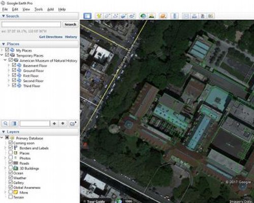
Cadastral,
Updates of plans
GIS applications

Having done millions
of cadastral plots
for different French departments,
we are expert in
cadastral mapping.
Having a great experience
of Public Utility
Mapping which includes
Gas, Sewerage,
Electric,
Telephone,Water, etc.
Net, C#, VB.NET, Web API, ASP.NET Core, MVC, Web Forms, Entity-framework, Win Forms, Web Services, IOS/Android Apps.
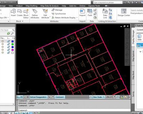
We offer CAD conversion,
. creating civil,
. architectural maps,
. drafting maps
from raster
images.
We have already made GPS Map of Pakistan which include all roads and POI some 400k addresses in (Lahore, Karachi, Islamabad).
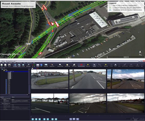
Made Road Assets Inventory Collection Project using road assets video survey for Yotta UK, which provides their own Software “Nano” along with surveyed videos to make a digital inventory of Road Assets.
+ more